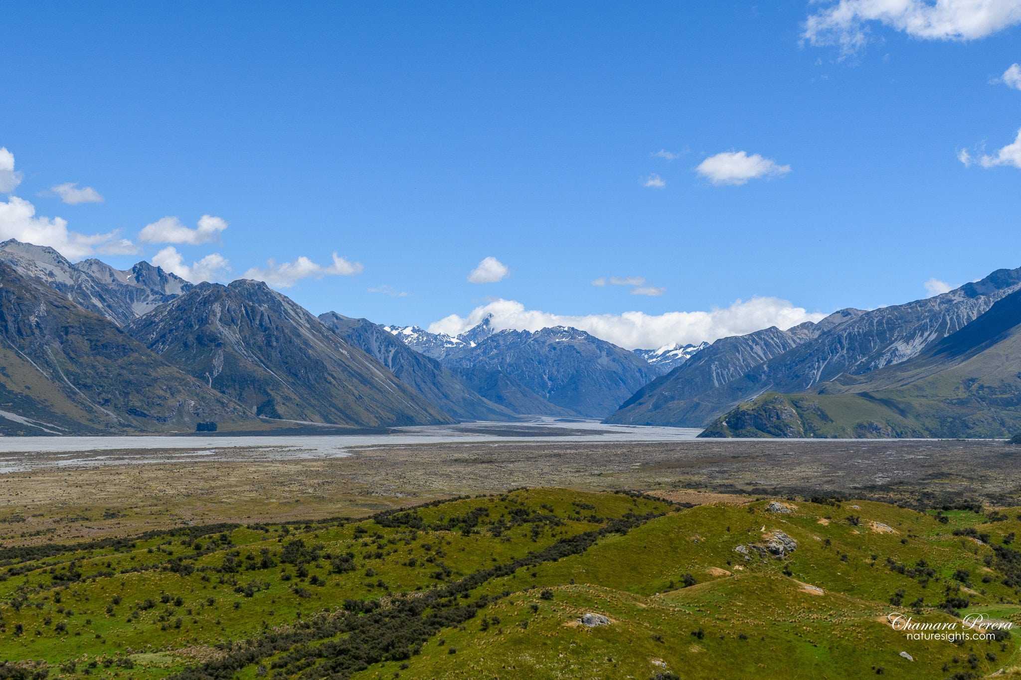
The Rangitata Valley does not ease you in gently. One minute you are driving through flat Canterbury farmland with poplars lining the paddocks, and the next the road drops off a ridge and you are looking down at a wide braided river valley with snow-capped peaks on three sides. That is when I understood why Peter Jackson chose this place.
Mount Sunday sits at the confluence of the Rangitata and Clyde Rivers, about 100 kilometres southwest of Christchurch. It looks nothing like a movie set. There is no sign, no car park attendant, no gift shop. Just a low, grass-covered hill rising from the valley floor, a swing bridge over a clear river, and the Southern Alps stretching away in every direction. Jackson used it as Edoras – the capital city of Rohan in The Lord of the Rings. The entire set was built here across nine months of construction. Nothing of it remains. But the landscape that made Jackson choose this spot is still exactly as it was.

Getting there: the drive from Lake Tekapo
I drove from Lake Tekapo, which takes a little over an hour on a clear day. The first section along State Highway 8 is sealed and straightforward, passing through the flat Mackenzie Basin with views across to the Ben Ohau Range. At Burkes Pass the drive changes. The road drops toward the Canterbury Plains and the farming country gets greener, the hills closer.


You turn off toward Hakatere Conservation Park at Arundel and then onto Hakatere Potts Road. From here, most of the road to Mount Sunday is unsealed gravel. If you are driving a rental car, check your insurance policy before you set out. Windscreen chips are a real risk – loose gravel from passing vehicles, including farm trucks and the odd 4WD, throws stones at speed. Several rental companies explicitly exclude gravel road damage from their standard coverage. Worth knowing before you go, not after.
The road is not difficult, and the views as you drop into the valley are worth pulling over for.

First view of the valley
The descent into the Rangitata Valley is where the scale of the place hits you. The valley floor is wide and flat, a braided river system spreading across grey gravel beds, with mountain ranges closing in from three sides. On a clear day the Main Divide is visible directly ahead, snow-covered even in summer.


Rivers and streams near the site
The access road passes several braided river channels before you reach the car park. Wide, shallow, stone-bedded Canterbury rivers. In summer the water runs glacier-cold and very clear. I stopped at one crossing just to look at the colour of it.


The approach: lupins in season
In December and January, the roadsides near Mount Sunday fill with Russell lupins – tall blue and purple flower spikes growing in dense patches along the gravel tracks. I did not expect them. A dusty gravel road heading straight toward a wall of mountains, with purple lupins on either side – it is the kind of thing you stop and look at for longer than you planned, then keep looking at in your photos weeks later.


Crossing the swing bridge

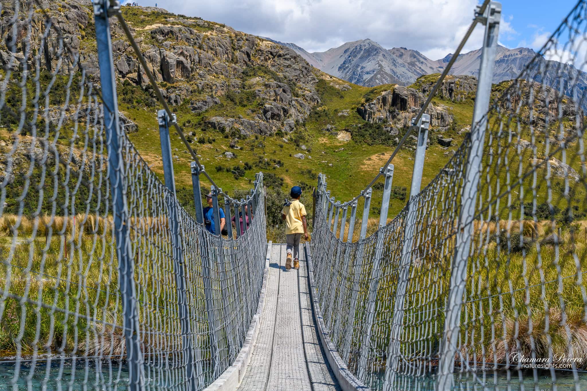
A swing bridge spans the river immediately below Mount Sunday. It bounces and sways when you walk on it, which is half the experience. From the bridge you get your first proper look at the hill – a rounded green dome above the valley floor, with the rocky upper ridge giving it just enough height to feel like a position worth defending. You can see why the location scouts chose it. A city built up there would be visible for miles in every direction. The Rangitata plain stretching south and the mountain walls to the north and west make it obvious.
Climbing Mount Sunday
The climb from the bridge to the top takes around 30 to 40 minutes return, depending on how often you stop to look at the views. The first section is a moderate slope through short tussock grass. The upper section passes rock outcrops before the ridge opens into the summit area.


There is no formal track. You follow the obvious worn path up the hill. Take water and sunscreen. There is no shade on the climb and the sun at altitude is harsh even when it does not feel hot.
The view from the top
Standing on the summit, I understood the Edoras scenes differently. The valley floor below is a wide braided channel of the Rangitata River – flat, grey-stoned, stretching back toward the mountains. The hills rise steeply on every side. On a clear day the snow-capped peaks of the Main Divide are directly to the west.
This is exactly the view Jackson shot in The Two Towers – the wide establishing shots of Edoras with the plains stretching away and mountains encircling it. The set designers built the Golden Hall up on this hilltop and used the real landscape as backdrop. Up here, the fictional geography of Rohan makes complete sense. It would be a defensible position. It would feel like the edge of the world.


I spent longer up there than I planned. The light changes fast in the valley and each shift throws different shadows across the mountains.
The wider Hakatere landscape
Hakatere Conservation Park covers over 70,000 hectares of South Island high country. Mount Sunday is the headline attraction but the landscape around it – tussock flats, high-country stations, braided rivers running off the Main Divide – is worth the drive on its own terms. The working farms that surround the conservation land are part of what makes the area feel genuinely remote.


Photography tips
The best light at Mount Sunday is morning. By mid-afternoon the valley floor sits in partial shadow and the mountains can look flat. Get there early.
The lupin shots work best in low morning or late afternoon sun when the colour is at its most intense. Mid-day light washes them out.
From the top, shoot toward the west for the mountains and braided river combination that mirrors the Edoras establishing shots. Bring a wide lens – the scale of the valley is hard to capture with anything longer than 35mm. I shot most of the wide landscape frames on my Nikon D850 with the Tamron 24-70mm at the wide end.
For the swing bridge, shoot from the river bank below rather than from the bridge itself. You get the bridge framing the hill beyond, which is a cleaner composition than shooting across it.
How to get there
Mount Sunday is in Hakatere Conservation Park, reached via Hakatere Potts Road in the Ashburton Lakes area. The address most GPS apps recognise is the car park on Hakatere Potts Road, Ashburton Lakes 7771.
From Lake Tekapo it is about 1 hour 15 minutes via Burkes Pass and Arundel. From Christchurch allow around 2 hours – head south on State Highway 1, then turn west through Methven. From Queenstown you are looking at around 3.5 hours, so most people coming from the south do it as a stop on the way to Christchurch rather than a day trip.
The final stretch of Hakatere Potts Road is unsealed gravel for around 25 kilometres. A 2WD car handles it in dry conditions. In wet weather the road can become slippery – check DOC road conditions before travel in winter or after heavy rain.
Best time to visit
Summer (November to March) gives you the most stable weather, long days, and reliable road conditions. It is also when the lupins are at their peak, typically late November through early January.
Autumn (March to May) is quieter and the valley light turns golden in the afternoons, but the lupins are gone and the days are shorter. Winter access is possible but the road can be icy and snowfall makes conditions unpredictable. Check with DOC before travel. Spring (September to October) is variable – snow patches can remain on the road and the weather changes quickly.
Where to stay
The nearest options are in Geraldine, about 55 kilometres east, or Methven, around 80 kilometres northeast. I did the drive as a day trip from Lake Tekapo, which worked well. If you want more time in the area, Geraldine is the closest town with a decent range of motels and holiday parks.
Practical tips
There is no entry fee to visit Mount Sunday or Hakatere Conservation Park. There are also no facilities at the car park – no toilets, no rubbish bins, nothing. Carry out whatever you bring in and sort out any bathroom stops before you leave the main road.
Check rental car insurance for gravel road coverage and windscreen chips before you drive – not after. Mobile coverage is limited to non-existent at Mount Sunday, so download offline maps in town before you head out. In wet weather the access road can ford river channels – DOC posts updates on road conditions and it is worth checking after heavy rain. No guided tour needed. The hill is freely accessible and you can find it easily with a GPS or offline map.
FAQs
What Lord of the Rings scenes were filmed at Mount Sunday?
Mount Sunday was used for Edoras, the capital city of Rohan. It appears mainly in The Two Towers (2002). The production built the full Edoras set here – nine months of construction – then removed every structure after filming. There is nothing left from the film on the hill. What you see is just the location as it was before they arrived.
Can you visit Mount Sunday for free?
Yes – no entry fee. Mount Sunday is part of Hakatere Conservation Park and open to the public. You need your own transport to get there, as no public buses serve the area.
Is the road to Mount Sunday suitable for all cars?
A standard 2WD car handles the gravel road in dry conditions. It is around 25 kilometres of unsealed gravel and can be rough after rain. Check DOC road conditions in winter or wet weather. If you are in a rental car, verify your policy covers gravel road damage and windscreen chips – a lot of standard policies do not.
How long does the Mount Sunday hike take?
Roughly 1 to 1.5 hours return from the car park, depending how long you spend at the top. The climb is moderate with no technical sections but no shade either. Bring water.
What is the best time of year to visit Mount Sunday?
Summer (November to March) for stable weather and the lupins along the access road. Late November through early January is the peak for the flowers. The valley can be snow-covered in winter and road conditions can close access.
I drove out in late afternoon with the sun still high enough to light the mountains on the far side of the valley. On the drive back along the gravel road, a 4WD towing a trailer came the other way and I watched a stone chip leave a small mark on my windscreen. Nothing serious, but a reminder. Check your rental coverage before you go.
The landscape here does not need the Lord of the Rings to justify the drive. It would be worth the gravel road even if nobody had ever filmed a movie there. The film location is the reason most people come. The valley is why they stay longer than they planned.
If you are doing the South Island road trip, add Mount Sunday to the loop between Lake Tekapo and Christchurch. It is about 90 minutes out of your way. Worth every metre of the gravel road.
